DO NOT ATTEMPT THIS CACHE ALONE.
DO NOT ATTEMPT THIS CACHE UNLESS YOU ARE FAMILIAR WITH HIKING ALONG THE COAST AND CLIMBING STEEP ROCK FACES.
In 2020 a geocacher unfortunately fell attempting the caches on this part of the island and hurt himself so badly he had to be airlifted to the mainland.
There are places where you may need to cut through the edge of the woods to avoid spots where the path has eroded away, or descend a steep cliff face to reach the beach. Do Not Attempt unless you are VERY steady on your feet, have proper footwear, and have others with you to assist if you get into trouble. A safer way to reach this cache is travelling the woods road from the lighthouse rather than following the coastline from the beach.
|
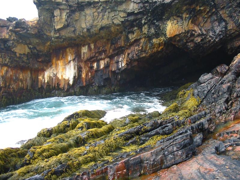
Sea caves are found all over the world in many types of rock. Unlike inland caves, which are often formed by chemical solution processes, sea caves are formed by the mechanical erosion of the ocean. Waves can hit shorelines with blows averaging several hundred pounds per square inch, and where there are faults or seams in the rock that create a weakness a cave can eventually develop. Since sea caves are created by the actions of the ocean they only extend inland as far as the ocean reaches. As a result, sea caves are often not very long, generally less than 50m, though some caves have exceeded 300m.
References
“The Virtual Cave: Seacaves”
“Speleology: Sea Caves”
“Scholastic: Caves”
“Wikipedia: Cave”
“sea cave – Encyclopaedia Britannica”
To log this cache, please e-mail me the answers to the following questions.
1) How high is the mouth of the cave? One way you can measure this is to use your GPS to take elevation readings near sea level and at the top of the cliff near the cave. *PLEASE BE CAREFUL* Do not stand on the cliff directly above the cave in case there is instability and overhang, and maintain a safe distance from the ocean if there are any waves.
2) Estimate the approximate depth of the cave from a safe vantage point. DO NOT ENTER THE CAVE TO MEASURE IT DIRECTLY. The length can be judged by standing on the rocks across from the cave mouth and a safe distance from the ocean waves.
To see a video of the area by the cave, click here.