|
So You're Looking for a
Great View?
Well, this is one of the
best views over looking the Olympia area!
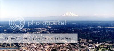
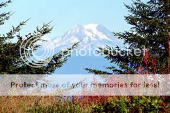
2,659 feet above sea
level, Capital Peak provides a wide view of the Puget Sound, Mt.
Rainier, and a wide panorama of the surrounding areas. Accessible
year around depending on your mode of transportation, a visit up
here is nearly always a pleasant experience. (weather dependant of
course) Capital Forest encompasses about 91,000 acres in the Black
Hills. It's a "working forest" providing many uses including
recreation, forest research, forest production, and natural habitat
for fish and wildlife.
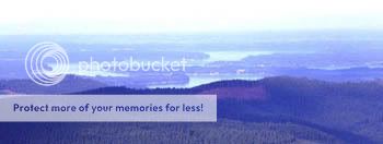
My
suggestion for best viewing is to plan when the air quality is good
but winds are low. Not an easy thing to time I know, but if the
summer haze is out, the viewing distance will be cut down. Just
something to think about anyway.
There's a labyrinth of roads and
trails criss-crossing Capital Forest, so a map is highly
recommended. Try the local outdoor outfitters or the Park
Headquarters on Black Lake Blvd across from Lumbermens. The Dept of
Natural Resources manages the forest, and is the maker of the map I
use. The trail system is divided into two user groups. The South
side of the forest is dedicated to horse riders and hikers. The
North is for Off Road Vehicles (ORV). Mnt bikers can access all
trails.
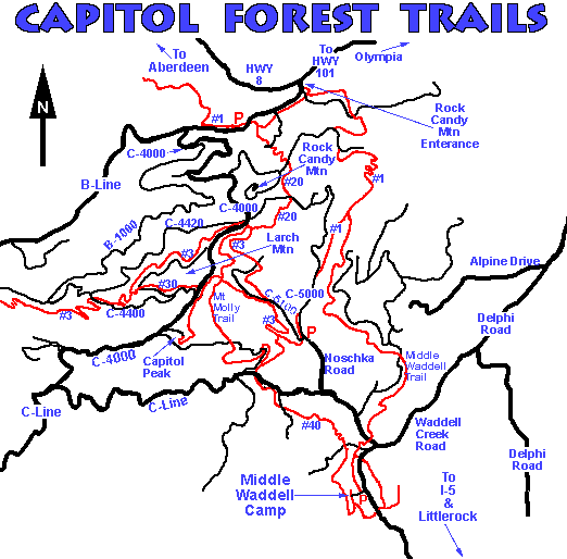
This abbreviated map does show the
main roads (black)and a few of the trails (red). Note Capital Peak
in the southwest quadrant. This is not even close to showing all
the side roads and trails intersecting the forest. The road
approaching Capital Peak from the SE is marked C-4200 on my map.
But while driving back down, we discovered the signs said 7000, no
wonder I missed it driving up.
There is a gate at the
bottom of the hill leading to the top. It's open sometimes, but not
always! So there is a possibility of having to hike the last
stretch to the top. It's a steep walk, so I'm rating the terrain
accordingly in case it is closed. If the gates open the terrain is
much easier since its nearly a drive up cache. While placing the
cache, we noted a 300' elevation gain and approximately 1/2 mile
from gate to cache.
Sitting on the peak is a
complex of communications equipment and towers. Just keep looking
in awe at the external view and accept the equipment as a necessary
evil for progress I guess. There are many other caches with fine
views in Capital Forest, so be sure to look for others to find
while enjoying a day in the Forest. Don't forget your camera and
have fun!
Nominated for Cache of the Month:
August 2007
|