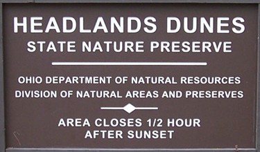
The posted coordinates will take you to the trailhead at
Headlands Dunes State Nature Preserve. From I-90, take OH-44
north to Headlands Beach State Park and park in the lot farthest
east. The dunes in Mentor are among the last examples of this kind
of Lake Erie habitat. Please stay on established trails and follow
all posted Ohio DNR preserve rules to
protect this resource. You will be walking through sand, which
should come as no surprise  Terrain rating was suggested by rating system
at clayjar.com. The dunes are near
to Headlands Beach, Mentor Marsh, and the northern terminus of the
Buckeye Trail.

Sand dunes are formed when sand settles and accumulates in a
spot which shelters it from the wind. Some types of vegetation
offer such safe spots for the sand to collect. In general, dunes
tend to grow around communities of plants that have vast root
systems to serve as anchors for the accumulation of sand. As the
plant life grows and the root systems expand, more sand is
deposited, and dunes are formed. As wind blows more sand to them,
the dunes grow large, the plant life thrives, and new species move
in. The sand dunes and the plants that live there are
interdependent. Without the plants, the sand would be blown around
instead of settling in one area. Without the dunes to grow on, the
successive species of plants would not have a favorable habitat. At
Headlands Dunes, the process began with an accumulation of sand
west of the mouth of the Grand River, creating a clear beach area.
Grasses and herbs with extensive root systems provided the first
anchors to stabilize the dune habitat. Once the dunes were
established, poplars began to grow, followed by aspen and oak. A
walk from the parking area to Lake Erie is a journey back through
the timeline of dune formation.
Some of the plant species at Headlands Dunes are rarely found in
Ohio and are much more common to Atlantic Coast environments. These
species are holdovers from the end of the Ice Age. The Wisconsonian
glacial episode lasted from about 117,000 years ago until 10,000
years ago. Toward the end of Wisconsonian glaciation, the Lake Erie
basin and much of northern Ohio were covered by a succession of
glacial lakes. As the glaciers advanced and receded, the seascape
changed many times. Similarly, the Lake Ontario region was molded
by glacial changes. At one point, that area was covered by the
Champlain Sea, a part of the Atlantic Ocean. Champlain Sea-side
species were near enough to migrate to what is now known as Mentor
Headlands. While the glaciers melted and the Atlantic shoreline
moved farther away, relics of the glacial period exist in plant
species such as beach grass (Ammophilia breviligulata) and
purple sand grass (Triplasis purpurea).

In addition to plant life and glacial influence, the human
factor plays a part in the development and continued existence of
the dunes. West of the mouth of the Grand River, the Mentor
Headlands are in an area along the earlier course of the river
channel. Erosive action moved the river outlet east to its present
location, while currents and winds continue to deposit sand where
the river once flowed. The Grand River and the port of Fairport
Harbor often play host to Great Lakes freighters (and sometimes to
the boatchicks who work on such freighters!) delivering cargoes of
limestone. Boats up to 730 feet in length are able to dock here.
Without human intervention, sandbars would form in the river
channel, creating a hazard to navigation and eventually blocking
access entirely. To help keep it clear, breakwaters were built to
help prevent the deposition of sand in the channel. This leads to
the accumulation of sand west of the breakwater, due to the
predominate winds out of the northwest and the Lake Erie currents
moving east toward the shore. In this way, human engineering
compliments the natural conditions that originally formed the dunes
to help sustain them.
LOGGING REQUIREMENTS: According to Earthcache rules, in
order to claim the find, you must perform an educational task. So,
I ask that you stop at a few waypoints to make some
observations.
1. At the trailhead, take a moment to find the preserve
brochure. What plants are referred to as “the most important
dune developers along the Lake and Ashtabula County coast”?
If there are no brochures available on your visit, try decrypting
hint #1 below 
2. At waypoint #1, you will be standing next to Lake Erie. Take a
look at the sand on the bare beach. How does it differ from the
sand you walked through to get here? Describe what’s
underfoot in your email. Also, please take a photo here of yourself
and your GPS (or just your GPS if you’re shy) and some nice
background scenery. There’s plenty of it! Post this with your
log.
3. No spoiler photos here, please! At waypoint #2, you will see two
large, impressive man-made structures. I’m not talking about
the breakwall, but rather, about things that can be seen from a
long distance. One structure is fairly commonplace in this type of
environment and is located fairly nearby. The other is a ways off
to the east and is one of only two such locations on Ohio’s
Lake Erie coast. (It’s far enough away that it could be
difficult to see in foggy conditions.) What are the structures?
Logs not accompanied by email and photo within a reasonable
amount of time will be deleted per Earthcache rules. I’d feel
rotten if I had to do that.
References:
Camp, Mark J. 2006 Roadside Geology of Ohio. Missoula,
Montana: Mountain Press Publishing Company
Marshall, Harold G.Succession in a Dune Community at Mentor
Headlands, Ohio
Ohio DNR
website (Thanks to Adam Wohlever for allowing this
Earthcache!!)