|
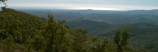
Serra do Caldeirão is
part of a major mountain system, which geographicaly separates
Algarve from the rest of the country. There are a few villages in
these mountains and the closest town is São Brás de Alportel. All
the region suffers from extreme demographic aging, with the
youngsters feeling the strong call of the sunny and rich coast of
Algarve or the far and bright Lisbon.
Economy in the region
is quite primitive and I believe cork business is the main
activity; production of Medronho, a strong liquor obtained with the
berries of a small tree called Medronho has also an important role
in the life of these people.
If the general
situation was poor, the giganting wildfire which destroyed a good
part of all vegetable life in these mountains in the Summer of 2004
didn't helped. An impressive number of cork trees was lost and the
whole ecosystem was affected. This fire took six days before became
under control and traveled for 120 km, which is a considerable
distance in a country with something like 700 kms separating its
southernmost from the farthest north.
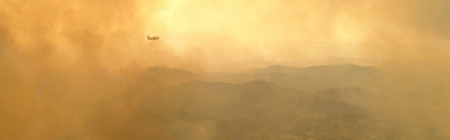
Wildfire in Alentejo
and Algarve, July 2004. Photos from the owner
collection.
All these region may
be pretty atractive for the tourist; half an hour driving from the
crowded beaches, an ideal solution for a diferent afternoon. People
will be impressed by the way tradition has been kept here.
Everything looks pictoresque and the traveler will be astonished by
the changes in landscape type, within such a short distance.
Besides, absolutely naturtal products can be bought in the small
villages: olive oil, "medronho", olives, fruit jams, oranges... and
so on.
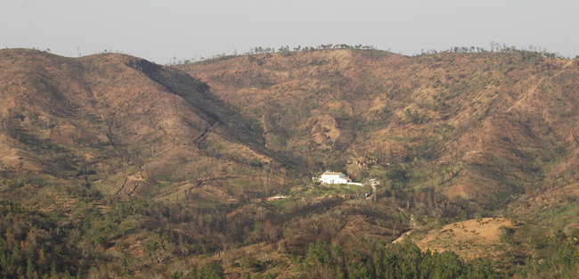
Please note the
impact of the wildfire. This farm had an awful time, completely
surrounded by flames. One year after, the consequences of fire are
still exposed in the landscape.
Sometimes, cool events
take place, even in this remote part of Algarve. Since 2005 the
Rally of Portugal takes place in these mountains, and in 2007 with
the aditional interest of beeing part of the WRC - World Rally
Championship. The competition, which is based in Stadium Algarve
(GCZ9WE), takes full advantage of the endless
dirt tracks spreaded all over the hills and offer an
unforgetable show for the lucky audience.
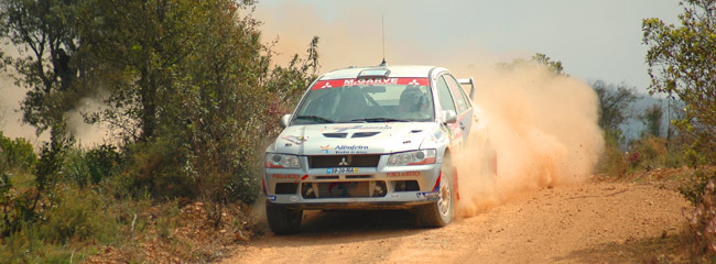
A Mitsubishi runs in the same track the geocacher will explore in
order to find this cache. Rally of Portugal, 2005.
Photo from the owner
collection.
The
Cache
This is a multicache,
which means the container will not be found at the given
coordinates. Instead, you will find there a touristic panel,
showing a map and interesting details about the region. It's kinda
of a crossroad, as the main road is crossed by a dirt road. The
spot is called Miradouro do Alto da Ameixeira. Take a look
at the map. There are two red rectangles with numbers inside. It's
the road numebrs. From the highest number, subtract the lower.
That's gona be X.
At this point the
geocacher will have to choose:
a) Takes the
hard and shortest way, which is by far the more
interesting one, and go by the dirt road. It's 5,9 km long and its
main atraction is the fact that's the same track used in one of the
stages of Rally de Portugal. Drive all the way to N37°
14.463 W7° 54.703. Report on road condition: last time I was there,
a regular car could use the road although there was one critical
point.
If you take option A perhaps you would like to download this
support material:

Official Map of the
Competitiom (1,5 Mb)
Track (formato .gtm) |
Track (formato .kzm)
B) Takes the
easiest and longest way, and drive around until you reach
the same coordinates: N37° 14.463 W7° 54.703.
Either way you will
end in the same place. Right there, you will find a small bridge.
What's the speed limit to cross the bridge? That's gonna be be
Y.
Final
Coordinates
Latitude is N37°
12.K
K = X + 198
Longitude is W7º
57.Z
Z = 24 * Y +
19
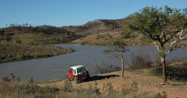
One
of the owners cachemobiles parked in the sugested picnic spot. A
few meters out of the scene there is an improvised stone table. See
waypoints for coordinates.
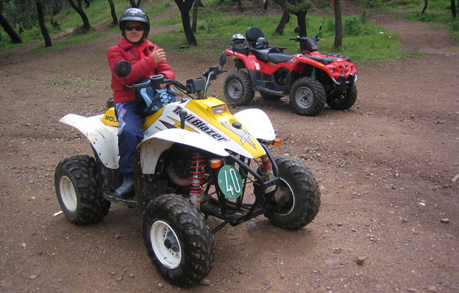
One
of the owners and two other cachemobiles of our fleet right in the
final cache location.
|